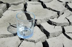
California water officials to meet with NASA, discuss drought
SACRAMENTO, Calif. — Officials from the California Department of Water Resources are meeting with NASA this week to discuss the state's ongoing drought, according to an article by Southern California Public Radio.
NASA tracks the levels of underground aquifers using satellites, noted the article, and will use that information to inform conversations about how to keep water supplies from getting dangerously low.
"As you pump water out of an aquifer the ground actually does subside or sink," said NASA geologist Tom Farr.
NASA sends radar signals to earth from the satellites to measure changes in surface elevation, the article reported, with increased pumping, drought and increased rain all affecting the ground level.
According to the article, NASA also uses data from the Gravity Recovery and Climate Experiment (GRACE) to monitor groundwater levels by measuring the mass of the Earth at various locations.
Farr explained that too much pumping can permanently damage an aquifer: “The aquifer system collapses to the point where it can no longer take in water," he said. "So you actually lose the ability to store water if you pump too much and it collapses too much.”
Read the full article here.
See Water Technology’s continuing coverage of the California water crisis here:
California governor declares state of emergency
WRD issues statement supporting California state of emergency declaration
Napa Valley vineyards could face reduced yield in 2014
PWQA donates $2,500 to Community Water Center
California organizations to host 2014 Drought Briefing
California irrigation equipment sales spike due to drought
